- Union identity
-
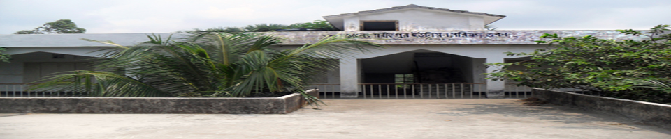
Union Council
Sharifpur Union
Union Council Services
- Govt. Offices
-
Other organizations
Educational Institution
Organization
- Various listings
- Projects
- Services
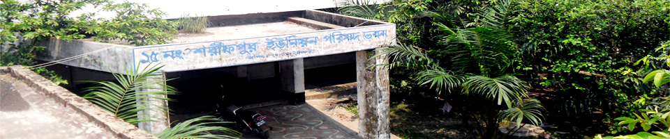
- Sharifpur UDC
- Union identity
-
Union Council
Sharifpur Union
Union Parishad activities
Union Council Services
Supportive information services
- Govt. Offices
-
Other organizations
Educational Institution
Organization
- Various listings
- Projects
- Services
-
Sharifpur UDC
Entrepreneur Profile
What is UDC?
What to get
Union Digital Center
Sharifpur Union No. 15 Sharifpur Union is situated on the south-eastern border of Begumganj upazila of Noakhali district. The other Union Parishad was known as Kadirpur Union No. 20, when it was connected with the present Kadirpur Union. After 1965, the district of Sharifpur with 25 mouzas was formed after the partition of Kadirpur. In 1955, Sonaimuri Upazila was formed. Founded in the name of Sharifpur Union no. 15.
Sharifpur Union Parishad No. 15 at a glance
Name of Union: Sharifpur Union Parishad No. 15
Upazila: Begumganj
District: Noakhali
Geographical boundary: Kadirpur East -16
West-Noakhali canal and the Ekalashpur Union No. 7
Hajipur union at the north-14 no
South-Noakhali sadar upazila
UP COMPEX: (a) Founded 02-03-2006
(B) Land: 0.72 acres
Size: 14.84 sq km / 1484 hectares
Village: 5 (Five) T
1. Sharifpur,
2. Sonepur,
3.Number,
4.Khanpur,
5.Muradpur
Total population: 38,900 people (a) Male - 0033 people
(B) Female-18867
(C) Hindus - 441 people
(D) Other- 22 people
** Agriculture Information-
Total land (1484 ha): (a) Awaited: 1077 hectares
(B) Non fatal: 407 hectares
(C) One crop: 1060 hectares
(D) Two crops: 40 hectares
(E) Three crops: 10 hectares
(F) Khas land: 40.18 acres (agricultural -6.03, non-agricultural-4.15)
Communication system: (a) Pucca Road - 20 km
(B) Kutch road- 58 kms
(C) Semi pucca - 1 kms
Literacy rate: 55%
Educational Institution :
(A) Primary school-government 8, Private-1, Total = 9
(B) High School - 02
(C) Madrasah-Senior Madrasa-4, Nurani Madrasa-12,
Ebtedi Madrasa -17, Forkania-32
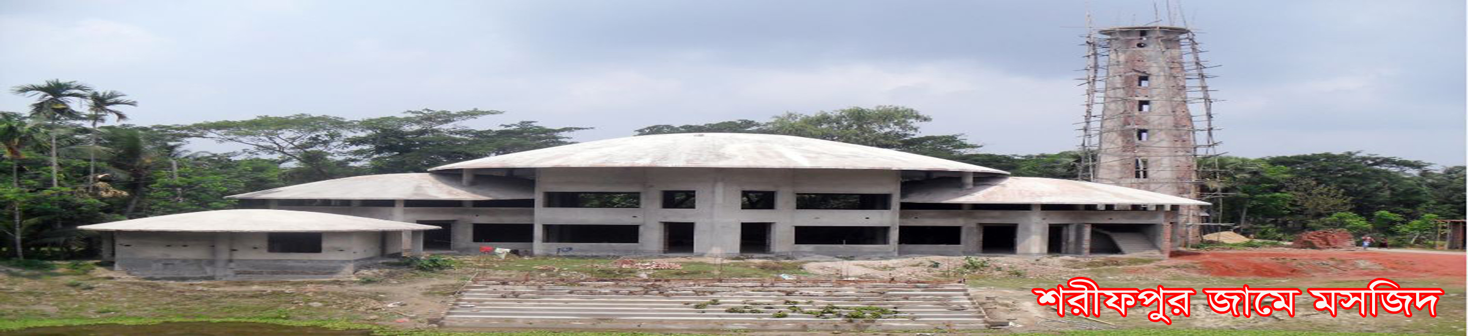
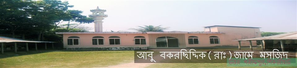
Mosque: 49
Temple: 01
Hat-Bazar: 01
Post office: 04
Health Center / Union Family Welfare Center: 01
Community Health Clinic: 0
Union Land Office: 01
Office of the Deputy Assistant Agriculture Officer 01
Agricultural seeding: 01 (abandoned)
Bank: 01 (Grameen Bank)
Mobile Tower: 01 (Grameen Phone and Banglalink)
Dairy farm: 10
Poultry Farm: 14
Fisheries farms: 68
Bridge: 10
Culvert: 42
Canal: 5 (15km)
Deep tube well: 65
Shallow tube-well: 454
Number of heroes freedom fighters: 113 people (beneficiary 34)
Older beneficiary: 490 people
Handicapped allowances: 52 people
VGD Cardholder:
Widowed Beneficiary: 183
Maternal Allowance: 20 people
A house is a farm: 540 people
Number of voters: 14605 [Male-6851, Female-7754]


Planning and Implementation: Cabinet Division, A2I, BCC, DoICT and BASIS
Technical Assistance:
![]()
Developed By:
